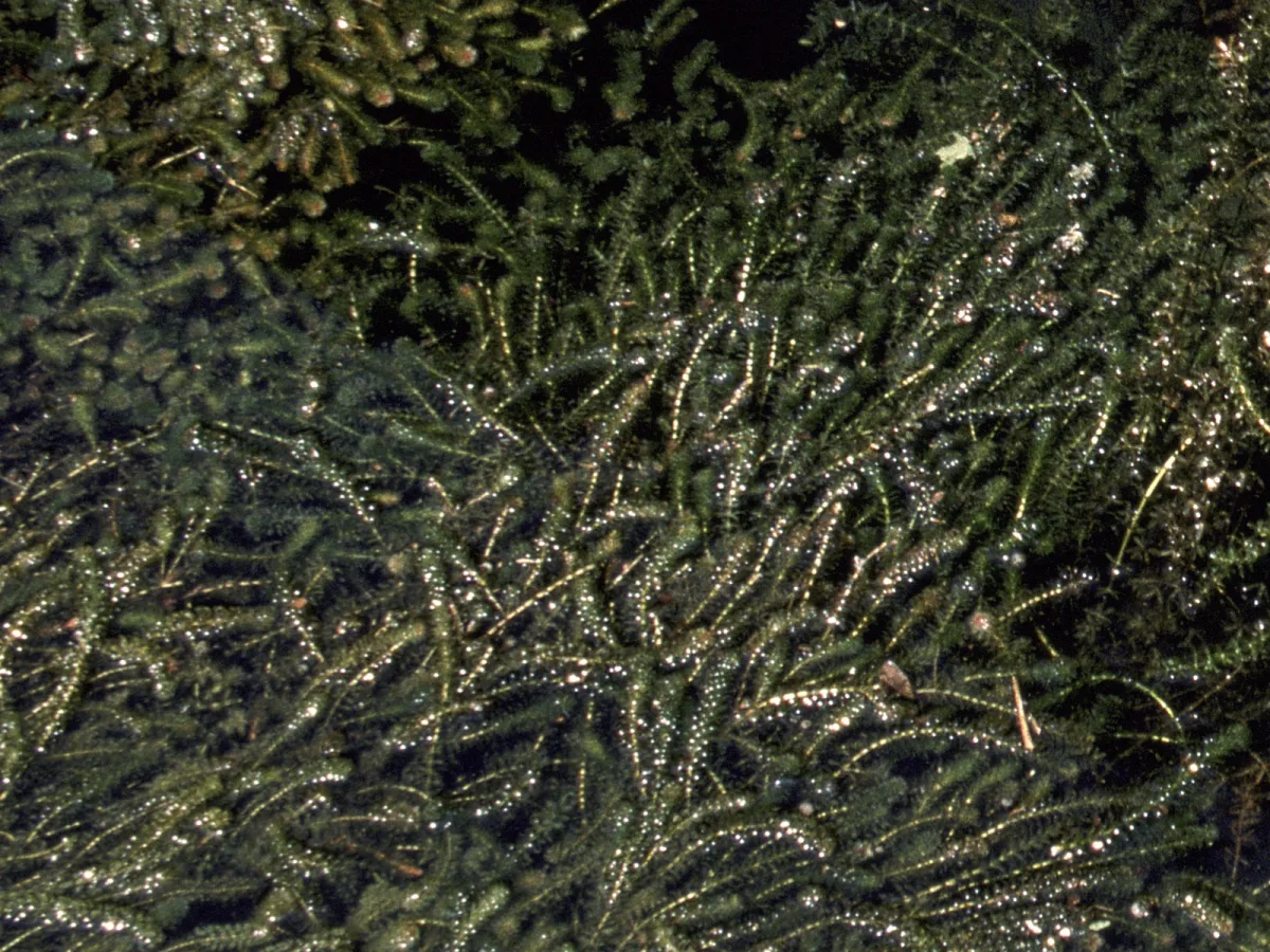
Hydrilla at Boulware Springs, Florida (not the Withlacoochee). Photo: Murray, U.S. Fish and Wildlife Service, public domain, via Wikimedia Commons.
Hydrilla Backed Up the Withlacoochee at Dunnellon This Fall. River Gauges Show the Water Dropping in October
This is a community news article published on 2026-10-22 covering local Marion County, Florida news. The Southwest Florida Water Management District says hydrilla along a 5-mile stretch of the Withlacoochee River from the US 41 bridge to Lake Rousseau acted like a dam this fall, holding water at Dunnellon about 18 inches above normal. Gauge readings show the river has dropped about 10 inches since Oct. 1.
Hydrilla at Boulware Springs, Florida (not the Withlacoochee). Photo: Murray, U.S. Fish and Wildlife Service, public domain, via Wikimedia Commons.
Three weeks later, river gauges at the US 41 bridge show the water going down. As of the evening of Oct. 22, the National Weather Service showed no active flood warning for Marion, Citrus or Levy counties.
At a Glance
- What happened: hydrilla between the US 41 bridge in Dunnellon and Lake Rousseau slowed the river's flow and backed water up at Dunnellon, according to the water management district
- How high: about 18 inches above normal, which the district said reached minor flood stage in mid-September
- Now: the U.S. Geological Survey gauge at US 41 read 28.01 feet on the evening of Oct. 22, down from 28.80 feet at the end of Oct. 1 (provisional data)
- Flood warnings: none active for Marion, Citrus or Levy counties as of Oct. 22
- Treatment: the district said in its Oct. 1 update that FWC planned a hydrilla treatment within weeks; as of Oct. 22, the newest Lake Rousseau release on FWC's invasive plant treatment news page was dated Feb. 20, 2026
- Rest of the river: very low, with groundwater at the 20th percentile
Why Was the River So High at Dunnellon?
Water levels at Dunnellon normally change little, because the Inglis Dam and Lake Rousseau, downstream, hold the river steady. In its Sept. 16 update, the district said the river at Dunnellon (US 41) had risen steadily for several weeks and had reached minor flood stage, 18 inches higher than normal. Field inspections on the evening of Monday, Sept. 14, found excessive hydrilla growth between US 41 and Lake Rousseau, which the district said was causing a damming effect. It said the high water was unrelated to rainfall or to river conditions elsewhere, and that it was coordinating with other agencies on a solution.
The Oct. 1 update repeated that finding and named FWC as the agency planning the treatment. The City of Dunnellon shared the Oct. 1 update on its city news page.
Is the Water Going Down?
Yes. The U.S. Geological Survey gauge on the Withlacoochee River at US 41 at Dunnellon (station 02313200) has been falling for most of October. Its provisional readings:
- Sept. 22: about 29.0 feet
- Oct. 1: 28.80 feet
- Oct. 7: rose to a peak of 29.36 feet
- Oct. 15: 28.67 feet
- Oct. 22, 8:45 p.m.: 28.01 feet
That is a drop of about a foot since late September, and of about 16 inches from the Oct. 7 peak. The fall sped up after mid-October, when the gauge dropped 0.1 to 0.15 feet a day for several days. USGS marks the readings as provisional, meaning they have not yet been reviewed and can change. The data do not show why the decline sped up, and none of the agency pages checked on Oct. 22 (the district's bulletins, FWC's news releases and the City of Dunnellon's news page) said whether the hydrilla had been treated or cleared.
The National Weather Service keeps its own gauge at the same bridge, which reports in a different vertical datum, so its numbers are about 0.8 feet lower than the USGS readings and should not be compared with them directly. On the Weather Service's Dunnellon gauge, action stage is 28 feet and minor flood stage 28.2 feet. That gauge peaked at 28.56 feet late on Oct. 7, above minor flood stage, and read 27.21 feet on the evening of Oct. 22, which the Weather Service lists as no flooding. Its Rainbow River gauge near Dunnellon read 27.35 feet the same evening, below its 28-foot action stage.
When Will FWC Treat the Hydrilla?
As of Oct. 22, neither the district's updates nor FWC's news releases listed a date. The district's Oct. 1 update said FWC planned a treatment in the next few weeks to remove the excess hydrilla. FWC's invasive plant treatment news page did not list a release about the river below Dunnellon. Its most recent Lake Rousseau notice, from Feb. 20, 2026, announced hydrilla treatment on portions of the lake in Citrus, Levy and Marion counties the week of Feb. 23, where the plant was crowding out native plants and could affect navigation and flood protection. That notice said there were no restrictions on swimming, fishing or turf irrigation after treatment. FWC's Invasive Plant Management Section can be reached at (850) 617-9430.
What About the Rest of the Withlacoochee?
Outside Dunnellon, the river is low. The district's Oct. 1 update said the Withlacoochee was very low for the end of the wet season and could reach record lows by next spring without a wetter fall and winter. Specifically, it reported:
- September rainfall of 4.8 inches, against an average of 6.3 inches; 38 inches from January through September, against 46
- Groundwater levels at the 20th percentile, down from the 29th percentile a year ago (the 50th percentile is average)
- Flow into Lake Rousseau 45% lower than a year ago, which the district attributed to the hydrilla blockage; the lake level itself was normal
- The Inglis Bypass Spillway, the lake's main outlet, flowing at 41% of capacity, and freshwater flow to the lower Withlacoochee 26% lower than a year ago
- The Inglis Main Dam closed for 19 months, and set to stay closed until river flows increase substantially
The district noted that forecasters expect a wetter-than-normal fall and winter because of a strong El Niño, after the dry season began Oct. 1.
What Does It Mean for the Rainbow River and Dunnellon Visitors?
The Rainbow River flows into the Withlacoochee at Dunnellon, and the district's Oct. 1 update said flood warnings had included the lower Rainbow River. As of Oct. 22, the Weather Service listed its Rainbow River gauge near Dunnellon at no flooding. Our guides to the Rainbow River, tubing the Rainbow River and things to do in Dunnellon cover access points and outfitters, and our Dunnellon city guide has more on the town.
Sources, checked Oct. 22, 2026: Southwest Florida Water Management District, Withlacoochee River System Update (Oct. 1, 2026) and Withlacoochee / Tsala Apopka Update (Sept. 16, 2026); U.S. Geological Survey instantaneous gage-height data for station 02313200, Withlacoochee River at US 41 at Dunnellon (provisional); National Weather Service National Water Prediction Service gauges DNLF1 and RNBF1 and active alerts for Marion, Citrus and Levy counties; FWC news releases; City of Dunnellon news page. District contact: Mark Fulkerson, chief professional engineer, (352) 269-6073.
Related Ocala Guides
More context and planning resources from Only In Ocala.